
1
/
of
1
Blue Vase Books
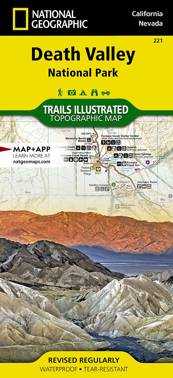
Death Valley National Park Map (National Geographic Trails Illustrated Map, 221)
Death Valley National Park Map (National Geographic Trails Illustrated Map, 221)
Regular price
$10.21
Regular price
Sale price
$10.21
Unit price
/
per
In stock
Couldn't load pickup availability
• Waterproof • Tear-Resistant • Topographic Map
Despite its foreboding name and the fact that it is the hottest, lowest, and driest area in North America, Death Valley National Park maintains a great diversity of life in its dramatic terrain of salt-flats, canyons, mountains, valleys, sand dunes, and badlands. National Geographic's Trails Illustrated map of Death Valley National Park delivers unmatched detail and valuable information to assist you in your visit to this land of extremes. Expertly researched and created in partnership with local land management agencies, this map features key areas of interest including Badwater Basin, Furnace Creek, Scotty's Castle, Panamint Springs, and Stovepipe Wells.
With miles of clearly marked trails that include mileages between intersections, this map will prove invaluable in your exploration of the park. A list of backcountry roads and trails complete with descriptions, lengths, and starting points will help you choose a route that's right for your activity level and recreation use. The map base includes contour lines and elevations for summits. Hot weather tips, a temperature chart, regulations, and safety suggestions are included as well.
Every Trails Illustrated map is printed on "Backcountry Tough" waterproof, tear-resistant paper. A full UTM grid is printed on the map to aid with GPS navigation.
Other features found on this map include: Amargosa Desert, Amargosa River, Badwater Basin, Bare Mountain, Black Mountains, Cottonwood Mountains, Death Valley, Eureka Valley, Funeral Mountains, Gold Mountain, Grapevine Mountains, Greenwater Range, Inyo Mountains, Inyo Mountains Wilderness, Inyo National Forest, Last Chance Mountain, Nelson Range, New York Butte, Owens Lake, Owens River, Owlshead Mountains, Panamint Range, Saline Valley, Sarcobatus Flat, Searles Lake, Telescope Peak, Towne Pass, Tucki Mountain, Ubehebe Peak. Map Scale = 1:165,000 Sheet Size = 37.75" x 25.5" Folded Size = 4.25" x 9.25"
ASIN: 1566953219
VSKU: BVV.1566953219.G
Condition: Good
Author/Artist:National Geographic Maps
Binding: Map
Note: Any images shown are stock photographs and product may differ from what is shown.
Condition Notes: The item shows wear from consistent use, but it remains in good condition and works perfectly. All pages and cover are intact including the dust cover, if applicable . Spine may show signs of wear. Pages may include limited notes and highlighting. May NOT include discs, access code or other supplemental materials.
SKU:BVV.1566953219.G
Please Note: Gift cards that are purchased in-store, cannot be used online. These must be used in-store.
Shipping & Local Pick Up
Shipping & Local Pick Up
Shipping: Most orders are shipped within 24 hours. Please allow 4-14 days after the item has shipped for delivery. Faster shipping is available for purchase at checkout.
Local Pick Up: Orders will be available for pick up within 24 hours. Pick up at the front desk Thursday-Sunday 10am-6pm .After hours pick ups are available Monday-Wednesday 7am-3pm at the Shipping & Receiving entrance.