
1
/
of
1
Blue Vase Books
Rand McNally Folded Map: Portland Regional Map
Rand McNally Folded Map: Portland Regional Map
Regular price
$6.52
Regular price
Sale price
$6.52
Unit price
/
per
In stock
Couldn't load pickup availability
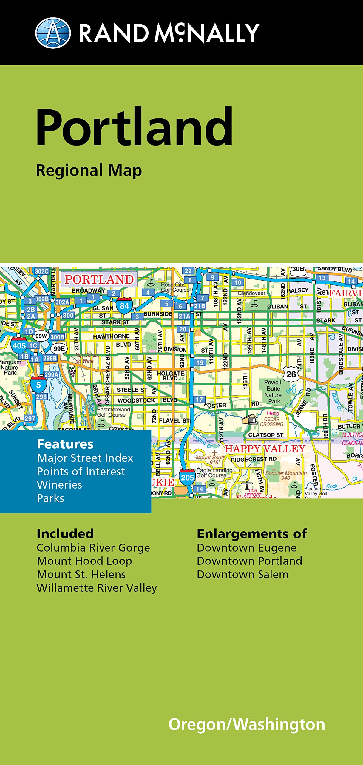
Rand McNally's folded map for Portland is a must-have for anyone traveling in and around this part of Oregon, offering unbeatable accuracy and reliability at a great price. Our trusted cartography shows all Interstate, U.S., state, and county highways, along with clearly indicated parks, points of interest, airports, county boundaries, and streets. The easy-to-use legend and detailed index make for quick and easy location of destinations. You'll see why Rand McNally folded maps have been the trusted standard for years. - Regularly updated. - Full-color maps. - Clearly labeled Interstate, U.S., state, and county highways. - Indications of parks, points of interest, airports, county boundaries, downtown & vicinity maps. - Major attractions & Golf Courses. - Enlargements of Eugene downtown, Portland downtown, Salem downtown. - Easy-to-use legend. - Detailed index & Major Street Index. - Convenient folded size. Coverage Area: Columbia River Gorge, Mount Hood Loop, Mount St. Helens, Willamette River Valley. Product Details: Measures 9.5 x 4 and folds out to 40 x 28.
ASIN: 0528025627
VSKU: BVV.0528025627.G
Condition: Good
Author/Artist:Rand McNally
Binding: Map
ASIN: 0528025627
VSKU: BVV.0528025627.G
Condition: Good
Author/Artist:Rand McNally
Binding: Map
SKU:BVV.0528025627.G
Please Note: Gift cards that are purchased in-store, cannot be used online. These must be used in-store.
Shipping & Local Pick Up
Shipping & Local Pick Up
Shipping: Most orders are shipped within 24 hours. Please allow 4-14 days after the item has shipped for delivery. Faster shipping is available for purchase at checkout.
Local Pick Up: Orders will be available for pick up within 24 hours. Pick up at the front desk Thursday-Sunday 10am-6pm .After hours pick ups are available Monday-Wednesday 7am-3pm at the Shipping & Receiving entrance.